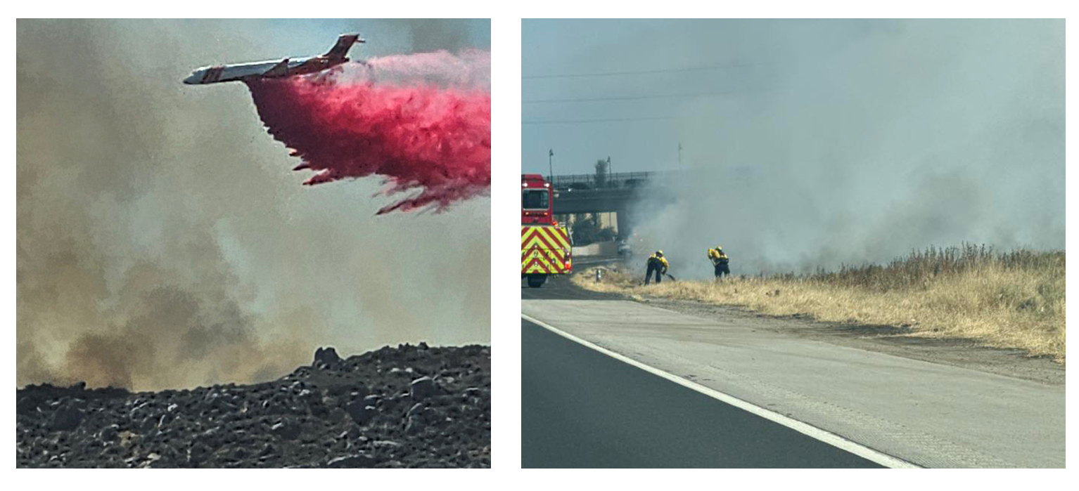


Left: A plane drops fire retardant on the Verona Fire. Right: Firefighters clean up after a fire on the side of the 215 Freeway at Newport Road. (Photos by Kelly Adger, Amber Zenzola)
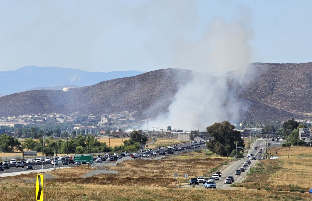
A plume of dark smoke rising from the hills east of Homeland raised concerns among Menifee residents on Tuesday. On the same afternoon, a smaller fire within the Menifee city limits caused big problems for motorists.


While the larger Bain Fire in Jurupa Valley and parts of Riverside grew to nearly 1,400 acres by late evening, the two Riverside County fires closest to Menifee ruined local air quality and left nerves on edge throughout the day.
The first sign of smoke was seen east of Menifee about 11:30 a.m. The Watch Duty app and CAL FIRE officials reported that the Verona Fire had started in a remote area near Juniper Springs and Verona Lane, between the community of Homeland and the City of Hemet. It was first reported as a 2-acre vegetation fire north of Highway 74 and east of Juniper Flats Road.
The fire quickly began to spread. By 2 p.m., it had covered 175 acres and had a potential spread to 500 acres, fire officials said.
Evacuation orders in the immediate area included the Four Seasons Mobile Home Park. Evacuation zones stretched from Juniper Flats Road east to California Avenue on the Hemet border. Additional engine crews and aerial attack planes were ordered as structures were threatened and the acreage grew to 250 acres.
An evacuation center was set up at West Valley High School in Hemet. An animal shelter was designated for large and small animals at the San Jacinto Animal Shelter.
“My friend has lost his home and animals. He’s lost everything. It is so sad,” wrote one resident of the area on the Menifee 24/7 Facebook page.
No information about loss of structures was reported by fire officials by late evening, but video of one structure burning was posted on several social media sites. No injuries were reported. About 6 p.m., signs of smoke were less visible in Menifee. But within an hour, fire officials described a flare-up.
“An additional 10 engines have been requested and the fire is making a downhill run toward structures,” Watch Duty reported at 7:15 p.m.
The acreage covered was reported at 600 soon thereafter but was adjusted to 439 about 9 p.m. At 10:30, the fire was declared 5 percent contained and stood at about 500 acres. Evacuation warnings were to remain in place overnight.
Meanwhile, at about 4 p.m., motorists reported a fire estimated at 1 acre burning between the southbound Newport Road off-ramp and the southbound lanes of the 215 Freeway in Menifee. CALFIRE confirmed the Interstate Fire, which was contained to an acre but created a huge cloud of smoke over a section of the freeway.
Southbound freeway lanes were shut down between McCall Boulevard and Newport while crews began to clean up remains of the fire.
That left motorists stranded on the freeway for about an hour until they were allowed to pass under the Newport Bridge or exit the freeway. Two hours later, smoke was still rising from the clean-up area.
“My wife and I were driving back down 215 from Sun City to the Newport exit this afternoon, and we smelled something burning as we went up the ramp but saw nothing at the time,” Tom Brosz wrote on Facebook. “We thought it had been smoke blown from the other fire. We went home and then I saw this in the feed. It must have just been lit somehow just before we went up the ramp.”
Neither the cause of that fire nor the other fires burning in the area have been determined.
By 10 p.m., the Bain Fire in the Riverside area had grown to 1,375 acres and was only 10 percent contained. The fire, which began in the Santa Ana River bottom in Jurupa Valley, resulted in evacuation orders in at least six zones.
On a day marked by fires burning throughout the Southland, there were also smaller fires in Hemet (17th and Kirby Streets), in several locations west of Riverside County, and the worst fire of them all – the Sandy Fire, which had covered 1,700 acres in Simi Valley and was only 5 percent contained.
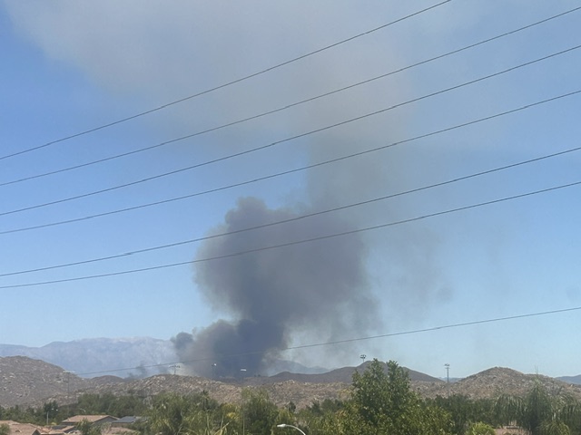 Smoke rising from the Verona Fire was visible from many parts of Menifee. (Staff photo)
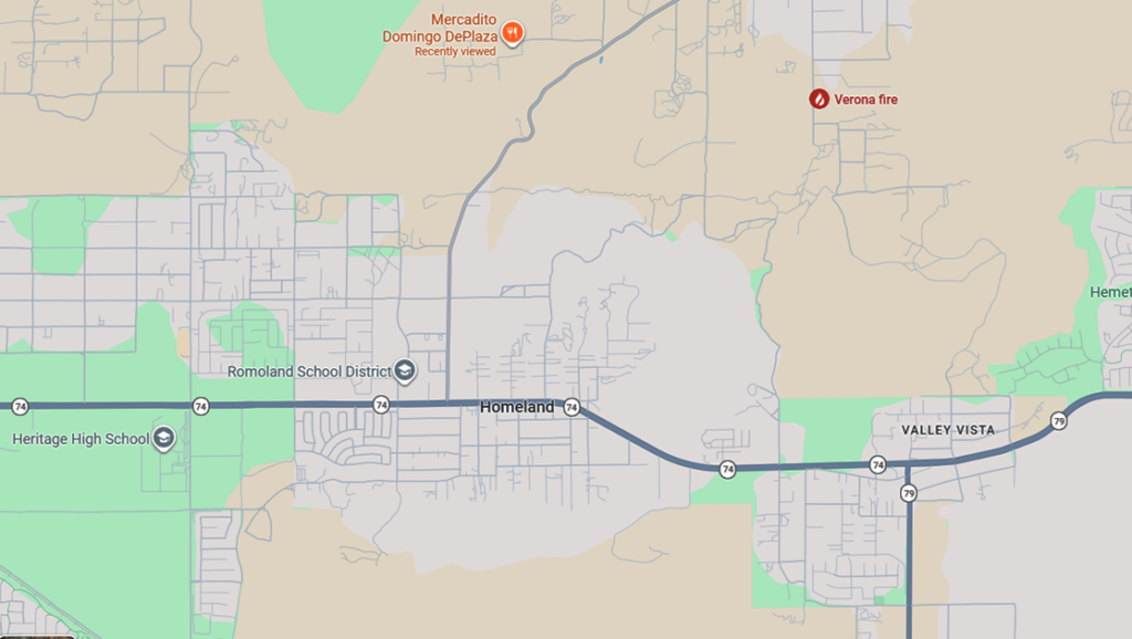 Map shows the location of the Verona Fire (upper right), north of the Valley Vista and Green Acres communities. Heritage High School is shown in the lower left corner.
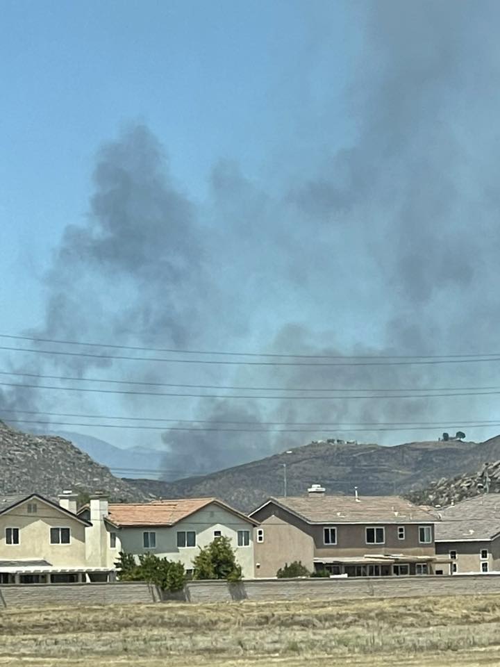 Smoke is seen rising in the distance behind homes. (Photo by Maggie Marino)
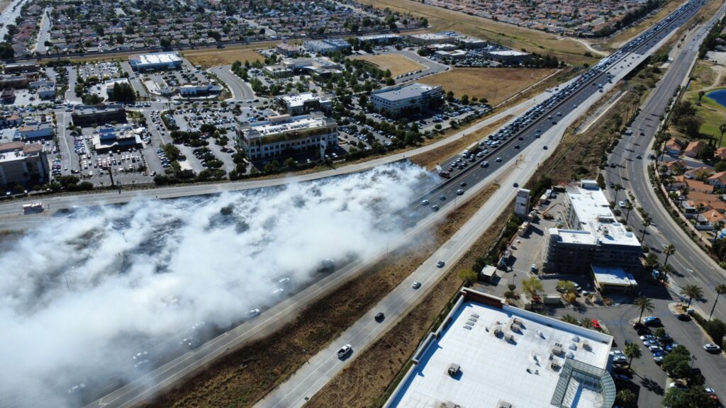 An aerial view of smoke from a fire along the 215 Freeway at Newport Road. (Photo by Austin Schwager)
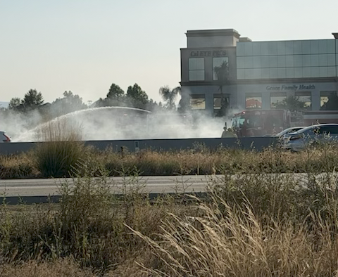 A view from the other side of the freeway shows the fire cleanup. (Photo by Caleb Hayes)
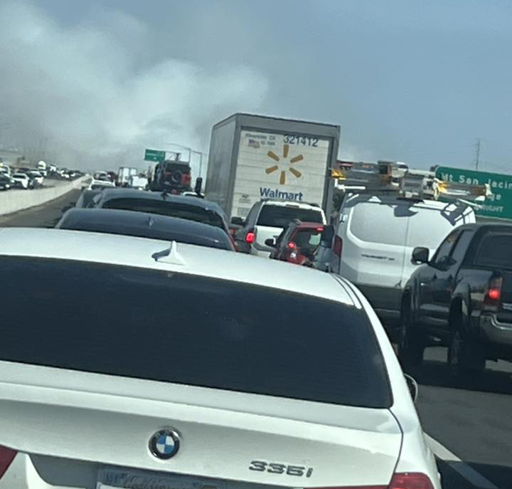 Rodney Madokoro had a first-hand view of the stopped traffic on the freeway.
 Smoke from the freeway is seen from the Scott Road bridge. (Photo by Gus ElGalleta)