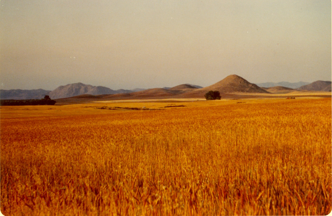




This 1970s photo shows what much of Menifee looked like then — acres of wheatfields with Bell Mountain in the background. (Photos courtesy of Menifee Valley Historical Association)
First in a three-part series on land use in Menifee.


If you think there’s disagreement about Menifee’s land management now, you should’ve been here 40 years ago, says one man who was.
Marion Ashley is a former Riverside County Supervisor who is retired and living in Menifee, where he grew up. When he was on the County Planning Commission in the mid-1980s, Ashley was assigned by County Supervisor Kay Ceniceros to head a committee to explore the potential for incorporating Menifee as a city.
How did that process go, Marion?
“It was tortuous,” Ashley said in an interview last week. “We met for several years on that.”
Back then, the only real residential community in the area was Sun City, a retirement community designed by Del Webb in the 1960s that is now a part of the City of Menifee. Most of the area in which residents now live was either large parcels of wheat and potato farmland or small ranches owned by what Ashley calls “the horse people”.
During that time, a series of meetings involving local residents were held at local schoolhouses. Ashley recalls one meeting he’ll never forget.
“The farmers were concerned about their ability to continue to farm,” Ashley recalled. “The horse people wanted to create horse trails. They wanted to be able to ride anywhere, and the farmers didn’t like that.
“This one meeting, the horse trails were brought up again. One famer said, ‘You’re not riding on my land. If anyone does, I’ll shoot him.’ Before I knew it, half a dozen fistfights had started. It was like a barroom brawl.”
One of the farmers was 70-year-old Clyde Christensen, a descendant of one of Menifee’s pioneer families. Ashley looked up and saw a young rancher pin Christensen to the wall with his fist cocked.
“The guy was ready to hit him,” Ashley said. “I went over there to break it up. I told the guy that Clyde had recently had heart surgery. He finally backed off.
“Right then I said to myself, ‘This is never going to get done.’ But about a month later we had another meeting and everyone was on their best behavior, like nothing had happened. It was like they were ashamed of themselves and wanted to get something done.”
They finally did, but it took some time. Compromises were made and County officials helped in facilitating the process. It would take another 20 years for Menifee to become incorporated, but developers were already starting to take notice of the area.
The Lusk Company, which purchased 1,997 acres of farmland in 1979, became the first developer since Del Webb when it applied to the county for a draft Environmental Impact Report (EIR). According to Ron Sullivan, a former County Planning Commissioner and still a Menifee resident, the land was previously used to grow potatoes by farmer Jim Minor of Agri-Empire Corporation, which specializes in the growing, packing, shipping, and exporting of white and red potatoes for fast food restaurants. The company, now owned by his descendants, is still active today in San Jacinto.
Contracting with nine building firms, Lusk oversaw construction of the Menifee Lakes community in the 1980s, including a manmade lake and golf course. That jump-started the growth of residential communities in Menifee. One by one, the original farming families began to sell off their property to developers as the farmers retired and saw the dollar signs waved in front of them.
Even so, officials back then had no idea Menifee would eventually explode to its current population of nearly 120,000.
“We figured there would be growth in the area and Menifee would become a city one day, but we had no idea how much it would grow,” Ashley said.
Since 2000, Sullivan has been a consultant with Diamond Brothers Five, which eventually assumed ownership of much of the area and still has some vacant property to sell in commercially zoned areas.
“We had no idea it was going to be this populated,” he said. “Once Lusk went in, the price of land went up. Houses around the lakes were selling for $125,000. Where else could you go back then and buy something like that?”
Other early developments included the community known as Rustlers Ranch west of the 215 Freeway. Then in the 1990s, the Heritage Lake community was built by another developer in the Romoland community now incorporated into Menifee. Economic development in that area has been slow; ground was just broken last week on a Stater Brothers grocery store to serve the community at the corner of Menifee Road and McCall Boulevard.
The contentious meetings of the 1980s evolved into more organized – but still at times contentious – meetings in the 1990s and early 2000s. Darcy Kuenzi, who moved to Menifee Lakes in 1992, was involved in several committees under the guidance of county officials prior to incorporation in 2008.
“Marion Ashley asked me to serve on the committee,” said Kuenzi, a former Menifee City Council member who recently moved to Arizona. “They picked two residents to work along with builders groups and others to try to unify the different opinions.
“There was an environmental group. There was a transportation committee that worked on what the roads would look like. You can’t get anywhere if you can’t get around. Then we had to plan areas with a sense of where people would shop and where industrial would be.”
As challenging as the task was, Kuenzi looks back and sees it as the same type of pains every community goes through in the natural process of growth.
“It was an emotional issue – but not just in Menifee,” she said. “It’s a difficult thing for people to understand because they’re so detached from the layers it takes to build projects and bring in services people need.”
Many of the different zones that exist today – residential, industrial, open space – were the same back then. Much of that map was followed during Menifee’s creation of its General Plan.
“The city established community centers where we wanted business,” Kuenzi said. “We decided where to put industrial buildings. It made sense, because there was an area already designated by the county.”
(That refers to two industrial zones – one that became the city’s Northern Gateway industrial zone south of Ethanac Road and the other, known as the Southern Gateway, along Zeiders Road next to the freeway. That topic will be addressed in another part of this series).
Some of the open space that today’s residents say they are beginning to miss was bound to be lost due to development as the housing market brought people in. Much of it was determined by the natural landscape, Sullivan said.
“When I was on the County Planning Commission and involved in planning afterward, we realized that some things would naturally be protected because there are slopes,” he said. “If the slopes are in excess of 25 percent, you couldn’t build on it. That’s how we decided there would definitely be some open space.
“After Marion left the commission and I was still on it, Kay [Ceniceros] appointed Marion as chairman of the Menifee area committee to put together the land use plan. The reason all that stuff south of Scott Road is designated as industrial is they needed something for jobs.”
Our examination of the industrial zone issue will be addressed on Tuesday. Meanwhile…
Tomorrow: A look at the process used by the City of Menifee Planning Department in evaluating residential and commercial development applications.
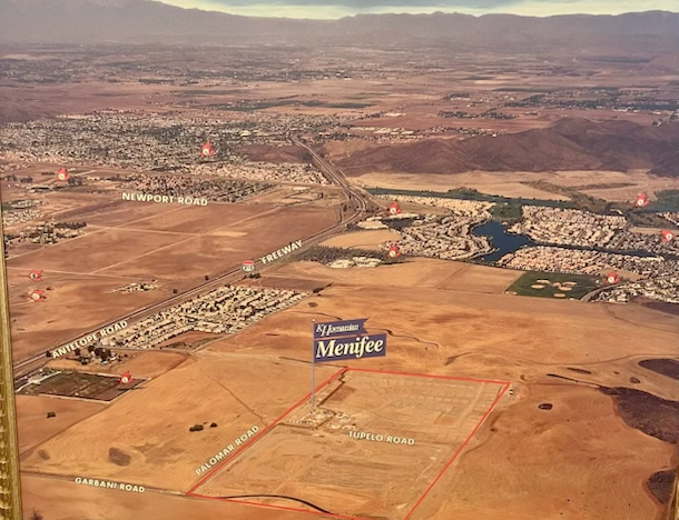
An aerial view of Menifee as the first developments came in, including Menifee Lakes.
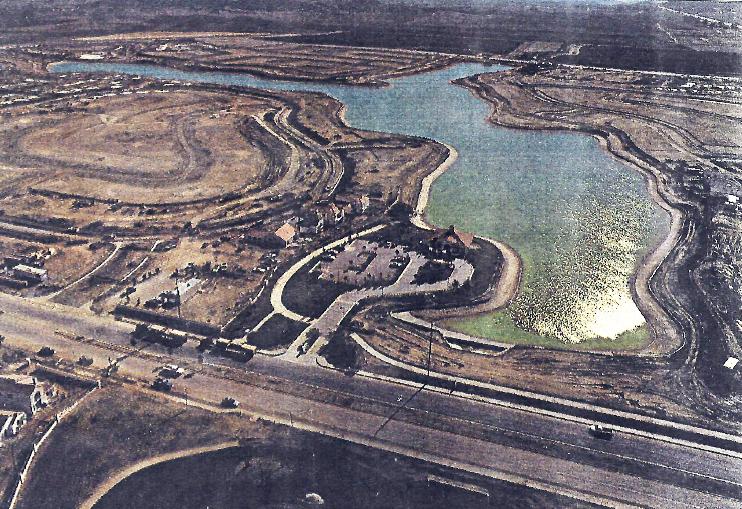
Another aerial view shows Menifee Lake just completed.
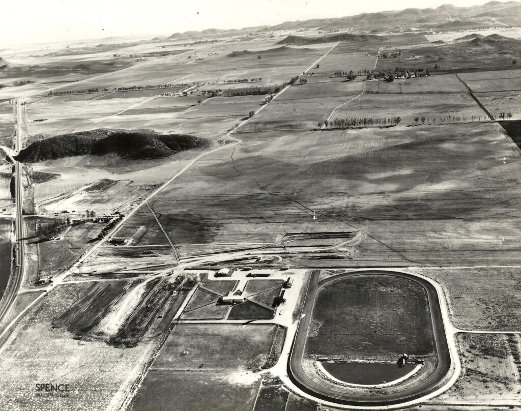
A 1960s photo shows the area that became Sun City, including a thoroughbred racehorse training facility.